|
Platform 5 at West Drayton, no longer used for passenger trains, only for the goods trains taking materials on the Staines line for the Terminal 5 works at Heathrow. This view is facing east. |
||||
|
Westward view of platform 5 in 1962 and the final Uxbridge to West Drayton train. photo: Phil Reeks. ©1962 |
||||
|
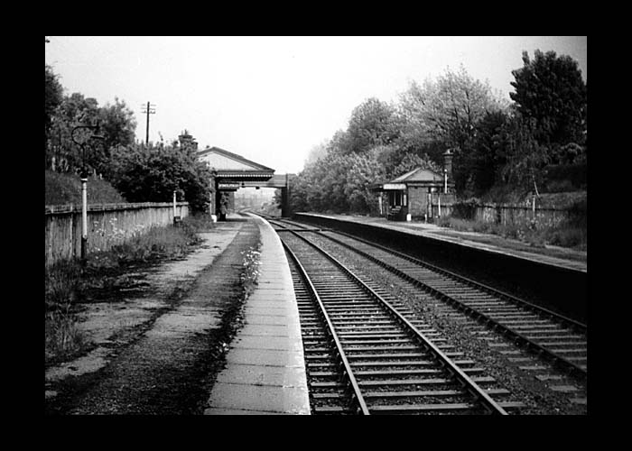
Looking at the main line west of West Drayton station. The right hand branch line can be seen veering off to the right. This is the route of the lines to Staines and Uxbridge Vine St. The two split not far from here: the Staines line returning in a southerly direction to run under the main line at a 90° angle to it, the Uxbridge Vine St line continued northward via Cowley. |
||||
|
There is so little left of this line that a walk of its route is a disappointing trudge along housing estates, some of them none too salubrious. |
||||
|
|
||||
|
Top level photo ©1962 Phil Reeks |
||||
|
Station Road but no station. |
||||
|
The hump in Station Road - the track area beneath the road has been infilled. The station was situated on the right of this photo, with access to the platforms gained via footpaths. |
||||
|
The small section of track bed parallel with Cleveland Road that has been retained as a nature reserve. |
||||
|
|
||||
|
South view of some reinstated track (with longitudinal sleepers!) and unknown wooden object. According to Charles Weaver "It's the bottom of a wooden pile. Large pointy post driven into the ground/riverbed to support a structure. This one has been cut off." The reason for its placement here is unknown. A more technical explanation from Doug Fleetney: |
||||
|
Westward view of The Greenway at the road hump caused by the railway running beneath it (to the rear of the approaching 4x4). (photo: 2005) |