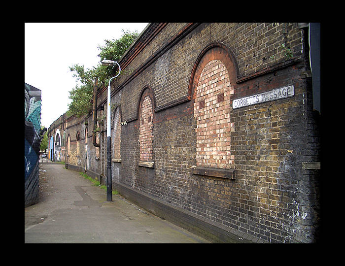
 View of the station on the corner of Rotherhithe New
Road and Corbett's Passage. South Bermondsey station, also seen
on this map, has since been resited a few hundred yards to the
south. The line veering off to the left of the map is the now
disused route to Bricklayers Arms terminus.
(May 2006)
View of the station on the corner of Rotherhithe New
Road and Corbett's Passage. South Bermondsey station, also seen
on this map, has since been resited a few hundred yards to the
south. The line veering off to the left of the map is the now
disused route to Bricklayers Arms terminus.
(May 2006)
|
The street level station building, just off Rotherhithe New Road,
looking southward.
(May 2006)
|

As above but viewed from the opposite direction.
(May 2006)
|
 Another entrance on Rotherhithe New Road.
(May 2006)
Another entrance on Rotherhithe New Road.
(May 2006)
|
 Space vacated by one of the platforms.
(June 2006)
Space vacated by one of the platforms.
(June 2006)
|
 Space vacated by one of the platforms.
(June 2006)
Space vacated by one of the platforms.
(June 2006)
|
 Aerial shot of the Southwark Park platform space,
looking north. The spread of the tracks here (south of Rotherhithe
New Road) is the only indication of the former station at track
level.
Image courtesy of Google Earth, an invaluable facility
for tracking disused lines and stations.
Aerial shot of the Southwark Park platform space,
looking north. The spread of the tracks here (south of Rotherhithe
New Road) is the only indication of the former station at track
level.
Image courtesy of Google Earth, an invaluable facility
for tracking disused lines and stations.
|
|
In April 2015, construction work revealed part of the platform foundations for the station. The links are here:
BBC
Evening Standard
|
|
|
|
|
|