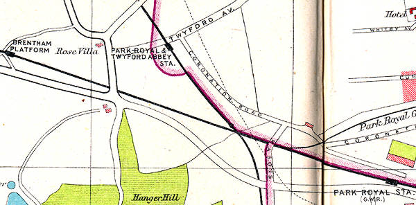
 1930s map showing the location of Park Royal &
Twyford Abbey station in the centre.
1930s map showing the location of Park Royal &
Twyford Abbey station in the centre.
Brentham station and Park Royal station on the left and right
extremities of the map, two G.W.R. stations, have both also now
been closed.
|
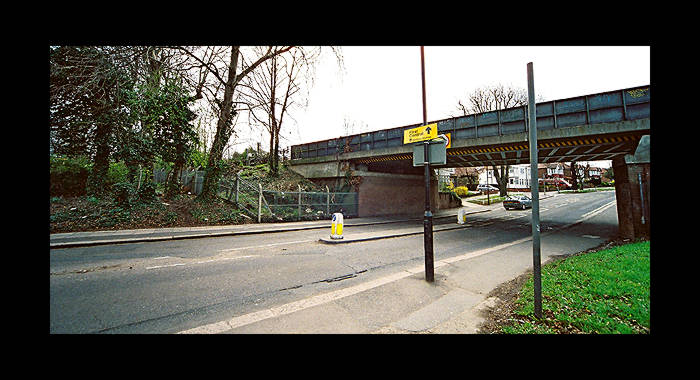 The station was located here, on the south side of
Twyford Abbey Road. The lightweight construction of the original
station meant that its post-closure existence was short lived.
The bridge and trackwork either side have since been replaced/modernised
thus removing all hope of finding the slightest remnant.
The station was located here, on the south side of
Twyford Abbey Road. The lightweight construction of the original
station meant that its post-closure existence was short lived.
The bridge and trackwork either side have since been replaced/modernised
thus removing all hope of finding the slightest remnant.
|
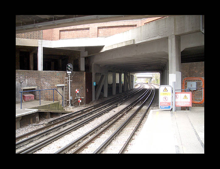 The replacement Park Royal station looking in the
direction of the old one. These newer platforms would have been
moved again, to the other side of the road supports seen here,
to be closer to the planned interchange with the new Park Royal
Central line station but Her Majesty's Rail Inspectorate would
not allow new platforms to be built on a slope. Full details
of the new Central Line station are here: www.alwaystouchout.com
(All photos Apr 2006)
The replacement Park Royal station looking in the
direction of the old one. These newer platforms would have been
moved again, to the other side of the road supports seen here,
to be closer to the planned interchange with the new Park Royal
Central line station but Her Majesty's Rail Inspectorate would
not allow new platforms to be built on a slope. Full details
of the new Central Line station are here: www.alwaystouchout.com
(All photos Apr 2006)
|