|
It was rebuilt largely underground in 1989-1991 as part of the new Thameslink passenger line. Three of the original stations on its route (or connected with it) have disappeared. |
|
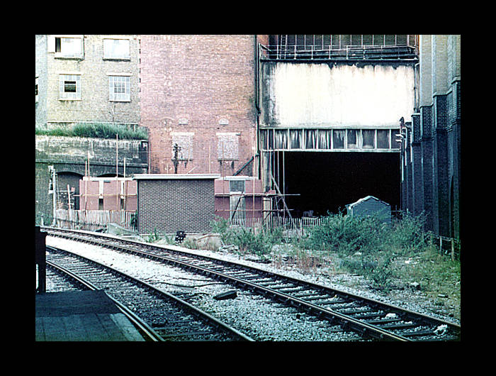
The Widened Lines at Farringdon station at the southern end of the station with a northbound train arriving prior to the line being electrified for Thameslink services. The tunnel on the right of the photo leads to Snow Hill - see below for details. (Photo: Paul Hepworth. © 2015)
|
||||
|
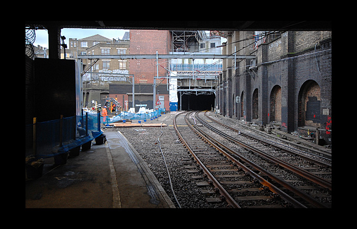
The reverse situation now exists i.e. the Thameslink line remains in use but the Widened Lines connection to Moorgate is closed. To cope with increased passenger traffic, the platforms at Farringdon needed to be lengthened to accommodate 12-car trains. The platforms could not be extended sufficiently at the northern end due to the steep slope of the track, so they had to be extended at the southern end, seen here. The extension cut across the area used by the Moorgate tracks, so the line to Moorgate was closed. Move your cursor over the above image to view it as it was in Jan 2007.
|
||||
 Wider angled view of the above in 2010. The tracks to Moorgate have been removed, although the curve of the platform accommodating the track has not been altered. The new platform extension to allow 12 car trains would be built in the space vacated by the track removal. There is little space for the northbound platform extension, as seen on the right of the photo - the entire building was demolished to make way for the extra platform space needed. For a dramatic transformation, move your cursor over the image to see the newly opened platform extension in Mar 2012. The new extension is in fact now treated as the main part of the Thameslink platforms - shorter trains stop at this end and not at the northern end, which has narrower platforms. |
||||
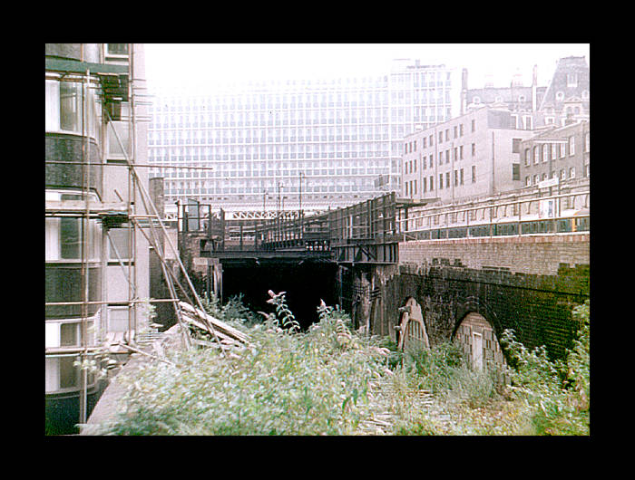 Northward view of the other end of the tunnel, rising to the surface north of Ludgate Hill in the late 1970s when the Snow Hill tunnel was reopened for through services. The intermediate station at Snow Hill (closed in 1916) still has some remains, visible from Thameslink trains travelling between Farringdon and City Thameslink stations. The viaduct on the right of the photos carries the (then) existing line to Holborn Viaduct terminus, the ticket office of which was housed in the office block visible in the photo above the tunnel entrance. (Photo ©2005. Simon Foster) |
||||
|
Holborn Viaduct terminus, serving South London, was closed in 1990 and replaced by City Thameslink station on the new sub-surface line that allowed services to run between North and South London again. |
||||
|
This central island platform was the last part of the station to see service. Before the final closure of the station, pre-demolition works involved dismantling the area to the right of the two central tracks. |
||||
|
A railtour train stationary on the eastern platform. |
||||
|
Looking south from Holborn Viaduct station. The train in the photo is passing the site of the long disused Ludgate Hill station. It did have an overall roof once and the chimney-like structure on the left of the line formed part of the station. |
||||
|
The aforementioned bridge carrying the line over Ludgate Hill, that blocked the view of St.Paul's Cathedral from Ludgate Circus and Fleet Street. As part of the rebuiliding of the line, this bridge was demolished and the line diverted into tunnels. The British Telecom telephone cables that ran under the pavement had to be diverted below the route that the tunnels were due to take. The cables were dropped into sixty foot shafts either side of the tunnel route, which gives an indication as to the fairly shallow depth of the tunnels. |
||||
|
The demolition of Holborn Viaduct in progress. |
||||
|
Westward view in 1979. The bridge over Ludgate Hill is on the extreme right of the photo. On the extreme left is the brickwork for Ludgate Hill station. |
||||
|
A view that provides good perspective of the short distances between the original stations: the substantial remains of Ludgate Hill station (closed in 1929) are on the left, the bridge over Ludgate Hill is in the centre with a bus passing beneath it, and the train visible on the track above and to the right is at Holborn Viaduct station. None of the railway structures shown in this photo exist today. |
||||
|
Ludgate Hill station in 1979 minus its roof. |
||||
|
Ludgate Hill station. |